


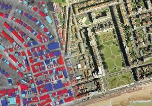
Aerial mapping specialist BlueSky has produced a colour-coded temperature map of Hastings to help the council to tackle fuel poverty and climate change. The map highlights properties that are losing the most heat so the council can take steps to better insulate its housing stock and premises. It also helps identify private properties that may be eligible for grants and other assistance. The survey data was captured using an airborne thermal infrared sensor on an early winter evening.
Source
Building Sustainable Design

No comments yet